Land use
Land-use analysis
Satellite-based land-use-change detection for ISCC Principle 1 and EUDR — with red LUC hotspot maps and audit-ready reports.
Land-use change (LUC) and deforestation risk are where feedstock sustainability is won or lost. FeedstockTrace assesses the parcels behind your material against satellite data, so you can show — not just claim — that the land qualifies.
-
Satellite detection
Built on Global Forest Watch / Hansen tree-cover data to detect change against the relevant cut-off dates.
-
Red LUC hotspot maps
Affected areas are rendered as red cells over satellite imagery, so reviewers see risk at a glance.
-
ISCC Principle 1
Supports the no-conversion-of-high-carbon-stock-land requirement central to ISCC sustainability.
-
EUDR deforestation-free
Geolocated assessment aligned with the EU Deforestation Regulation’s due-diligence expectations.
-
Audit-ready PDF reports
Every analysis can be exported as a document-backed LUC report for your certification body.
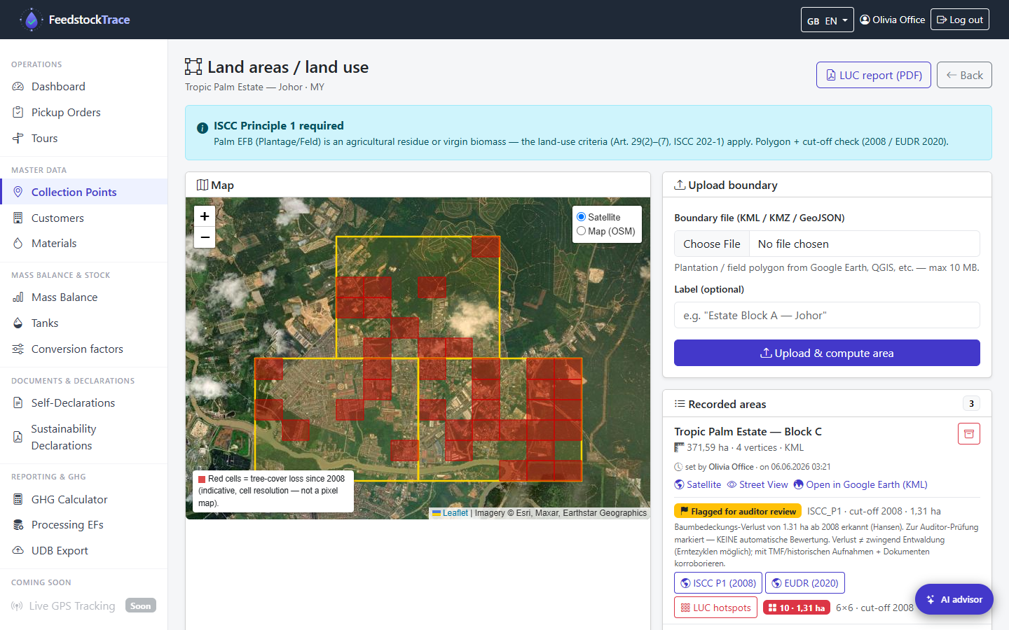
Parcel land-use analysis
Assess each parcel’s land-use status against the sustainability cut-off.
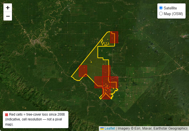
Satellite LUC hotspot map
Red cells mark tree-cover loss since 2008 (Global Forest Watch / Hansen).
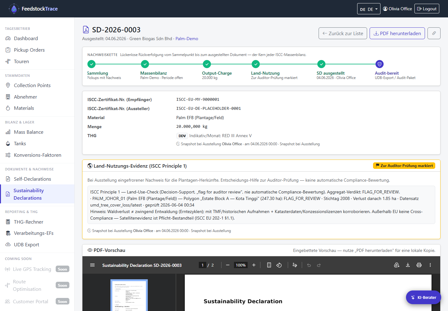
Land-use in the self-declaration
Land-use evidence is tied directly to the self-declaration for the batch.
Satellite analysis supports your due diligence; it does not replace formal certification or on-site verification.
See FeedstockTrace on your own data
Book a walkthrough and we will show traceability, land-use analysis and audit reporting end to end.
Or write to contact [at] feedstocktrace [dot] com
Operated by Glatow & Associates